This blog post may contain affiliate links, which are at no cost to you. It just helps support me so I can continue to put out free content for you like this! Thank you for your support!
Planning to visit Death Valley National Park but only have one day? Don’t worry — with the right route, you can still experience the park’s most iconic sights in just 24 hours. From colorful hills and vast salt flats to one of the best visitor centers I’ve ever been to, this one day in Death Valley itinerary will take you through some of the most unforgettable landscapes in the U.S.
I visited Death Valley with a friend in May 2025, entering from the western side near Lone Pine. We weren’t sure what to expect, but what we discovered was an incredible mix of jaw-dropping viewpoints, short hikes, and extreme desert beauty. With some planning, we managed to hit all the highlights — without feeling rushed.
In this post, I’ll take you through our exact itinerary stop-by-stop. I’ll also share driving tips, how much time to budget at each location, and what I’d do differently next time. Whether you’re coming in from the west like we did or starting near Las Vegas, this guide will help you make the most of your one day in Death Valley.
ARTICLE HIGHLIGHTS
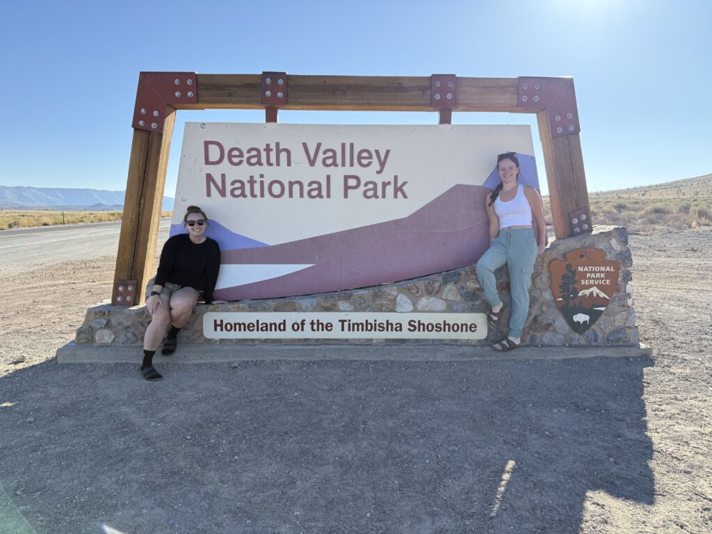
DEATH VALLEY NATIONAL PARK ENTRANCE SIGN
Coming in from Lone Pine, we entered the park through the western entrance — and of course, our first stop had to be the classic entrance sign. It’s the perfect place to mark the start of your adventure (because let’s be honest, pic or it didn’t happen, right?). We arrived around 7:45am, and it was so peaceful and quiet. There wasn’t a single car around — it truly felt like we were out there in the middle of nowhere. It was a quaint and serene start to the day. There’s a small pull-off for parking, and it’s a quick stop that sets the tone for the rest of the trip.
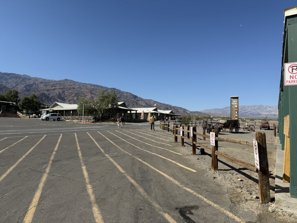
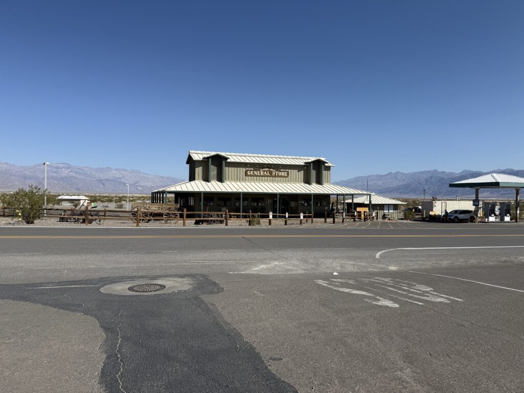
STOVEPIPE WELLS
Just about 28 miles from the entrance sign (around a 40–45 minute drive), the town of Stovepipe Wells is a convenient place to fuel up — both your car and yourself. This tiny outpost has a couple of gift shops offering snacks, beverages, and classic park souvenirs. If you didn’t grab water or snacks before entering the park, this is a good place to do it. Keep in mind, though: services in Death Valley are limited and spaced out, so top off your tank here before continuing deeper into the park.
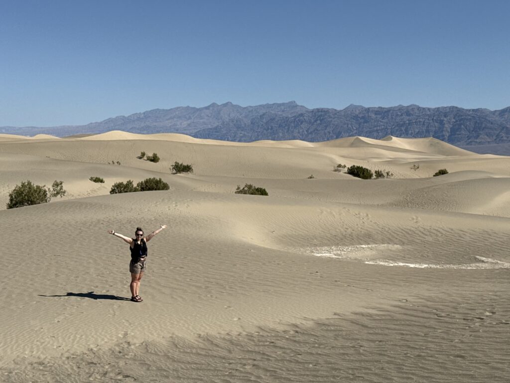
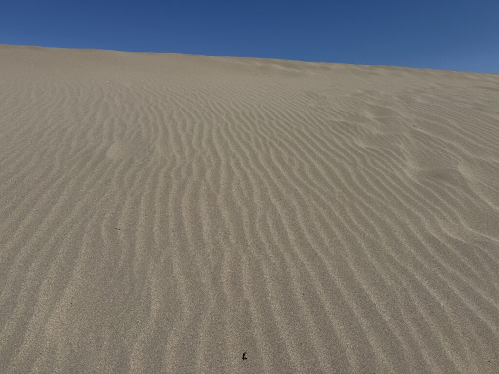
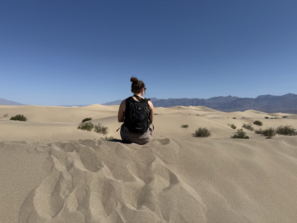
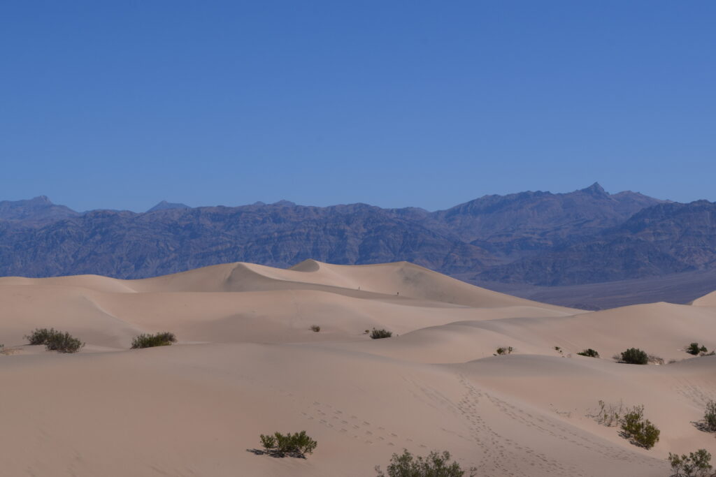
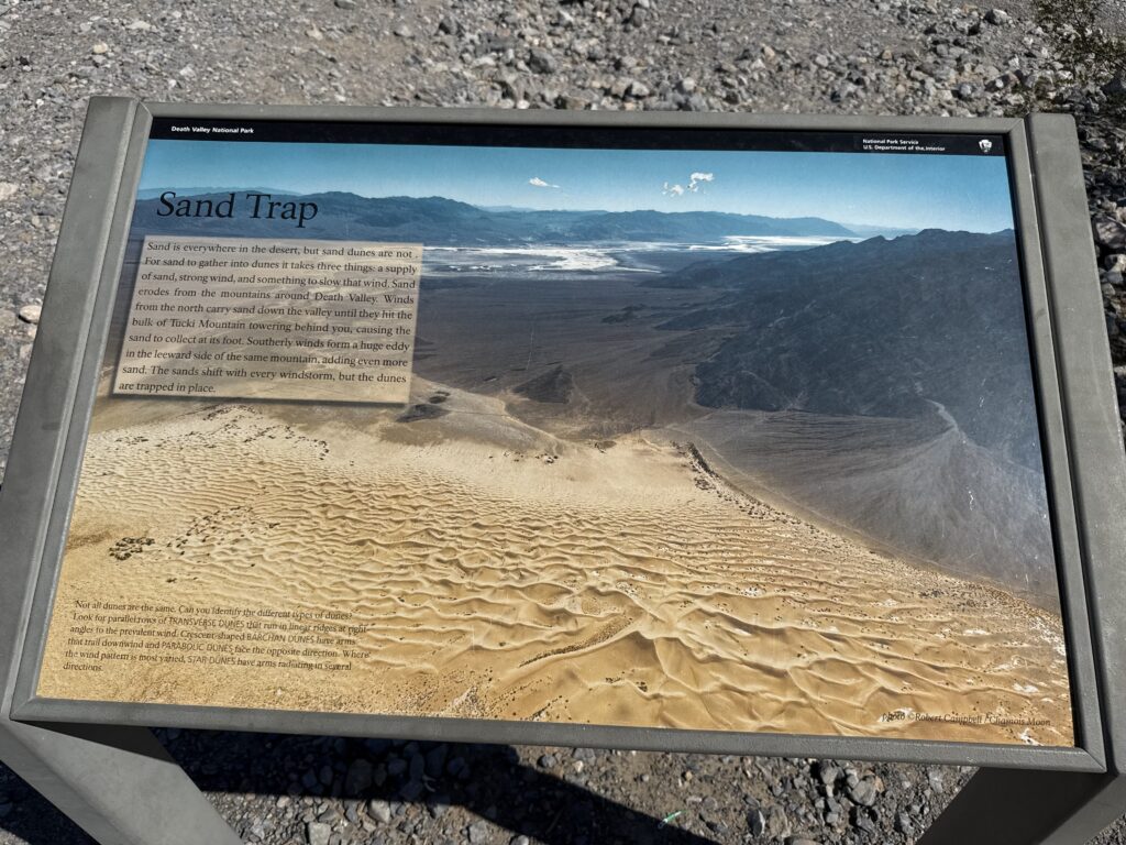
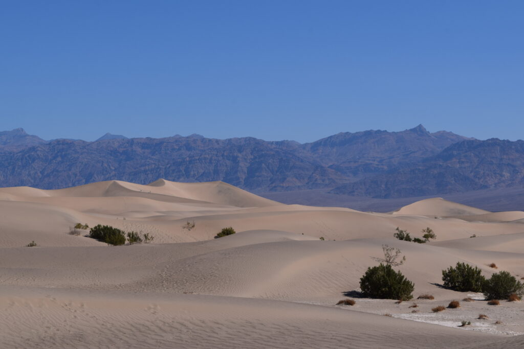
MESQUITE FLAT SAND DUNES
From Stovepipe Wells, it’s just a 5-minute drive east to one of the most iconic sights in Death Valley: the Mesquite Flat Sand Dunes. At first glance, they might not look like much from the road — but don’t be fooled. Once you step out of the car and onto the dunes, the landscape completely transforms. The dunes stretch far beyond what you can see from the parking lot, and walking among them makes you feel like you’re in a completely different world.
There’s no official trail here, which is part of the magic. You’re free to wander in any direction. The trek to the tallest dune is roughly 2 miles round trip, but even a short stroll will reward you with sweeping views and plenty of photo ops. Surprisingly, the sand was firm and easy to walk on, which made exploring way more enjoyable than expected.
Pro Tip: Get here early before the sun is too high. The lighting is stunning in the morning, and it’s much more comfortable before the heat kicks in.
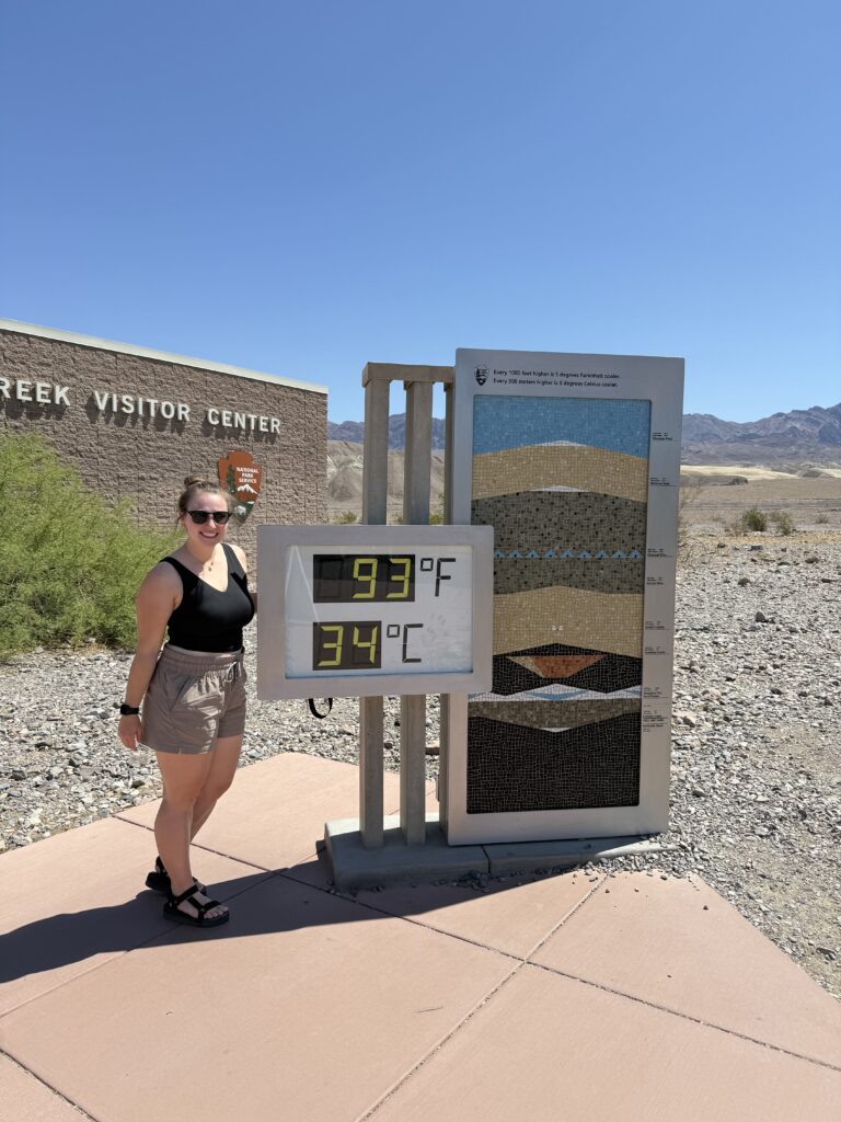
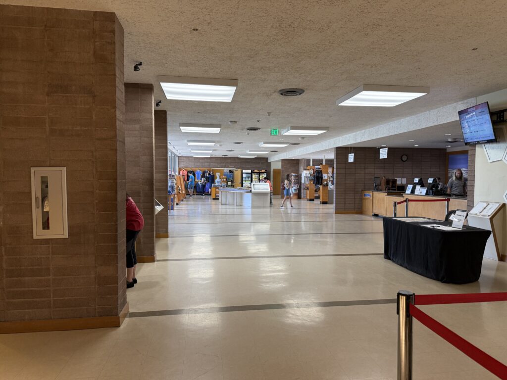
FURNACE CREEK VISITOR CENTER
After the dunes, we continued southeast to Furnace Creek Visitor Center, about a 30-minute drive from Mesquite Flat. Let me just say — this is one of the best visitor centers I’ve ever been to in a national park.
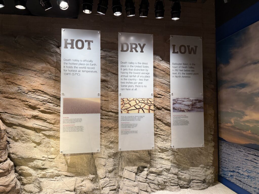
Right outside, you’ll find a giant thermometer proudly displaying the current temperature. It’s a fun photo opp and a reminder of just how extreme this desert environment can be (especially considering Death Valley holds the record for the hottest temperature on Earth).
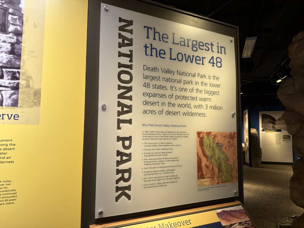
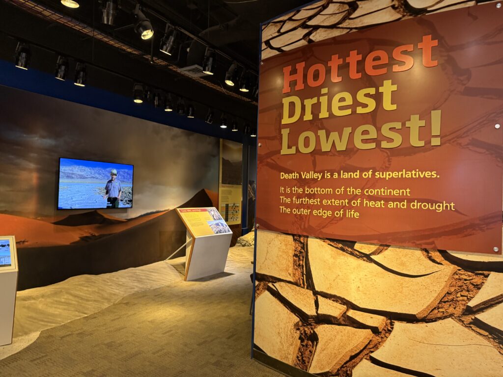
Inside, the visitor center has a solid selection of souvenirs, snacks, and beverages, but the real standout is the museum. I’m usually not a huge museum person, but this one was incredibly well done. I learned so much about the park’s unique wildlife, geology, and extreme climate. For example, did you know Death Valley only gets about two inches of rain per year?
This is also the perfect place to:
- Pick up your park map
- Chat with a ranger if you have questions
- Refill your water and grab anything you forgot
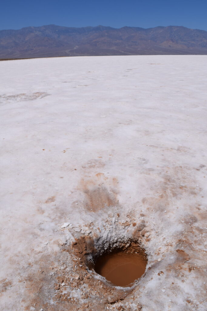
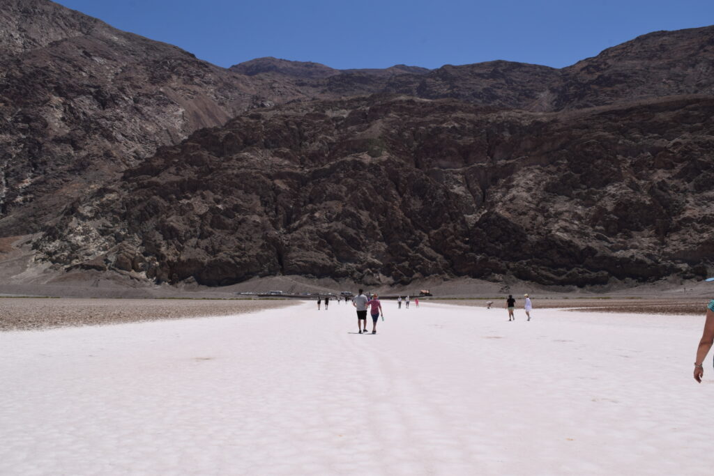
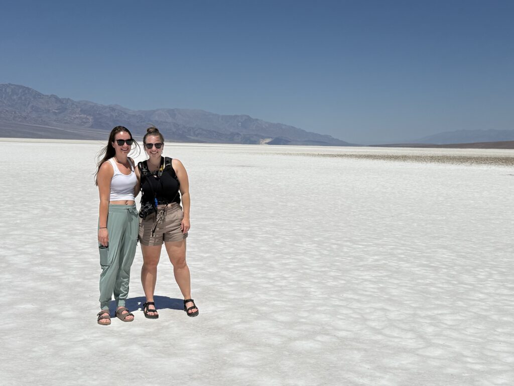
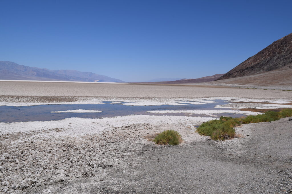
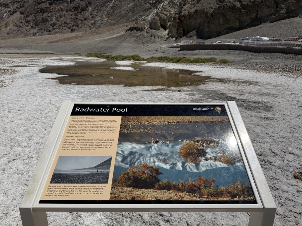
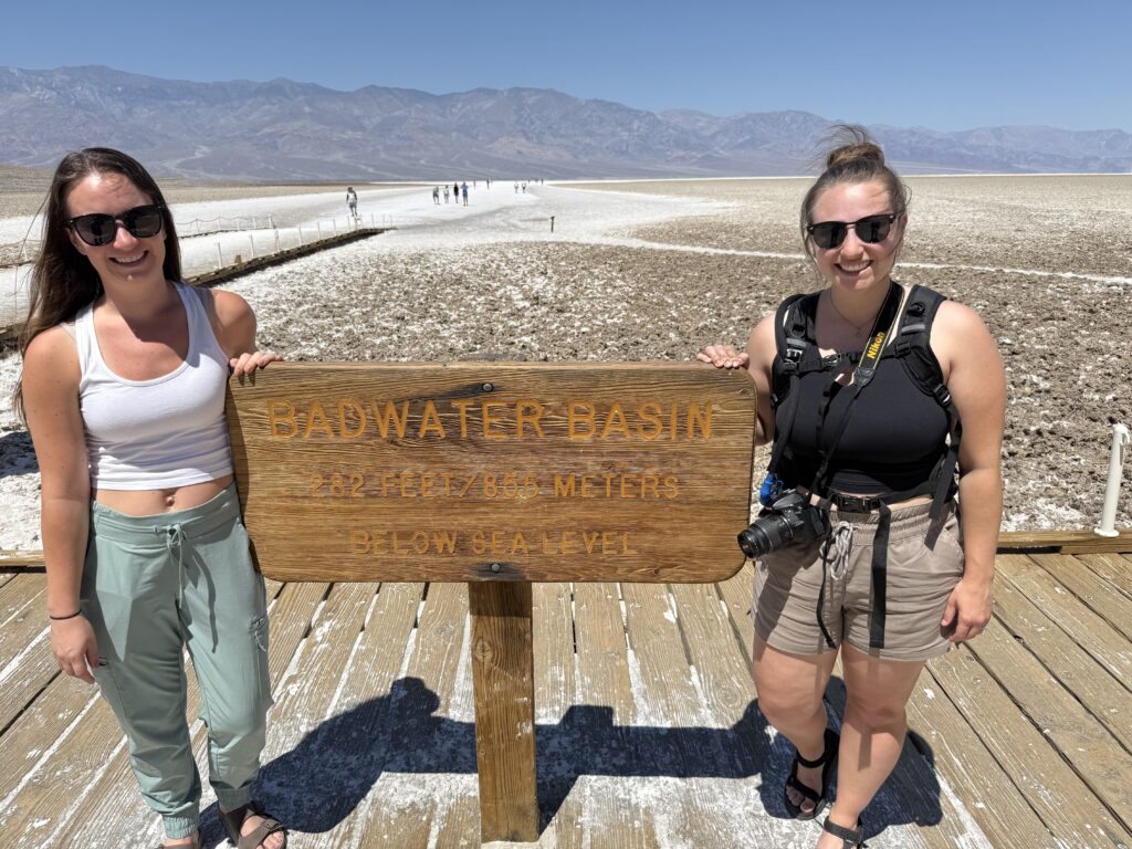
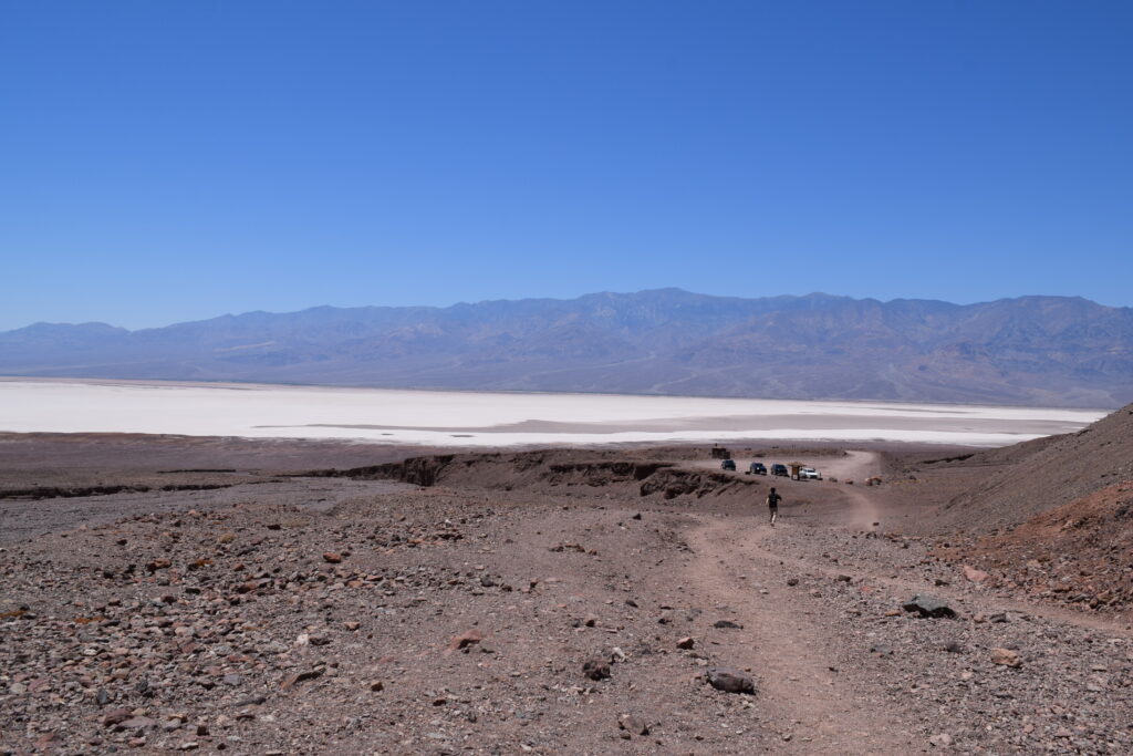
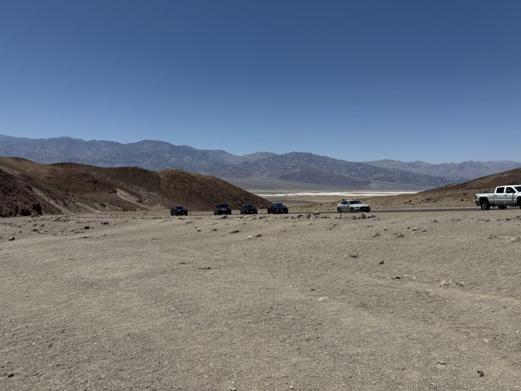
BADWATER BASIN
Next up was Badwater Basin, about a 30-minute drive south from Furnace Creek. This is one of the most iconic — and surreal — spots in the park. At 282 feet below sea level, it’s officially the lowest point in the United States and North America.
From the parking lot, it’s a short and flat walk out onto the salt flats. At first, the surface looks almost like snow — but up close, you’ll see the rough, geometric patterns of crystallized salt stretching as far as the eye can see. You can walk out as far as you want, but even a quick 10-minute stroll gives you a feel for the vastness of the landscape.
It’s a strange and beautiful place that truly feels like another planet. And while it can get hot fast, there’s almost always a breeze blowing across the flats.
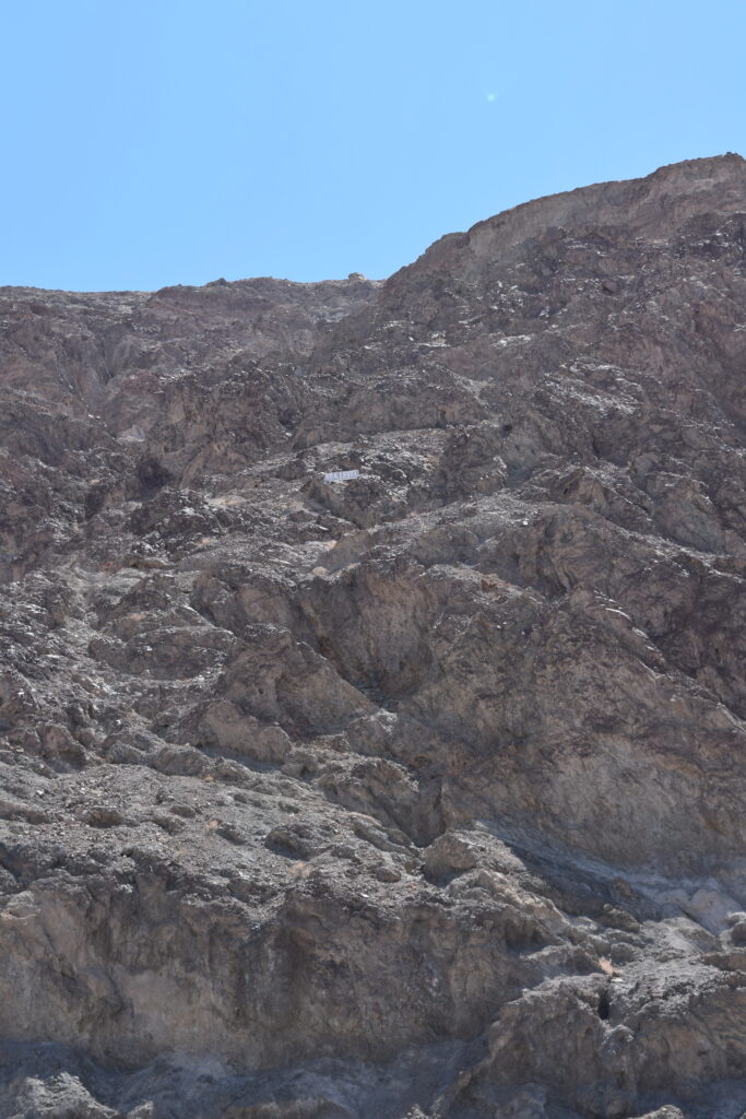
Pro Tip: Look back at the parking lot to spot the “Sea Level” sign posted high up on the cliff behind you. It really puts into perspective just how low you are!
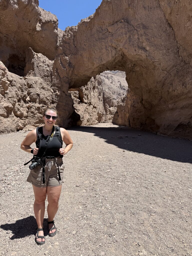
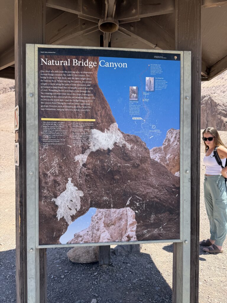
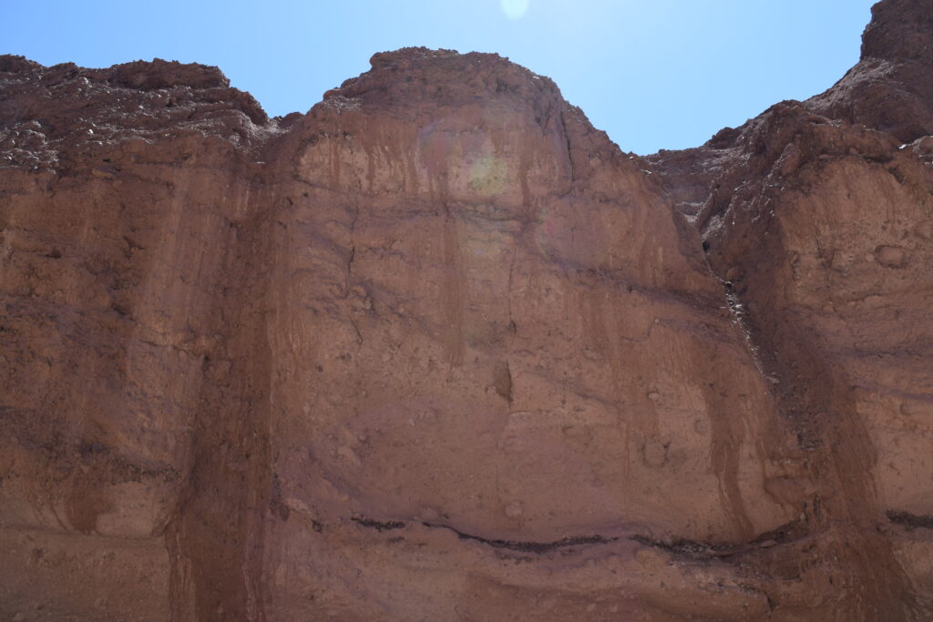
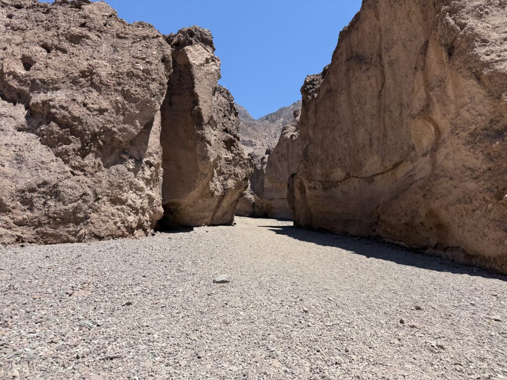
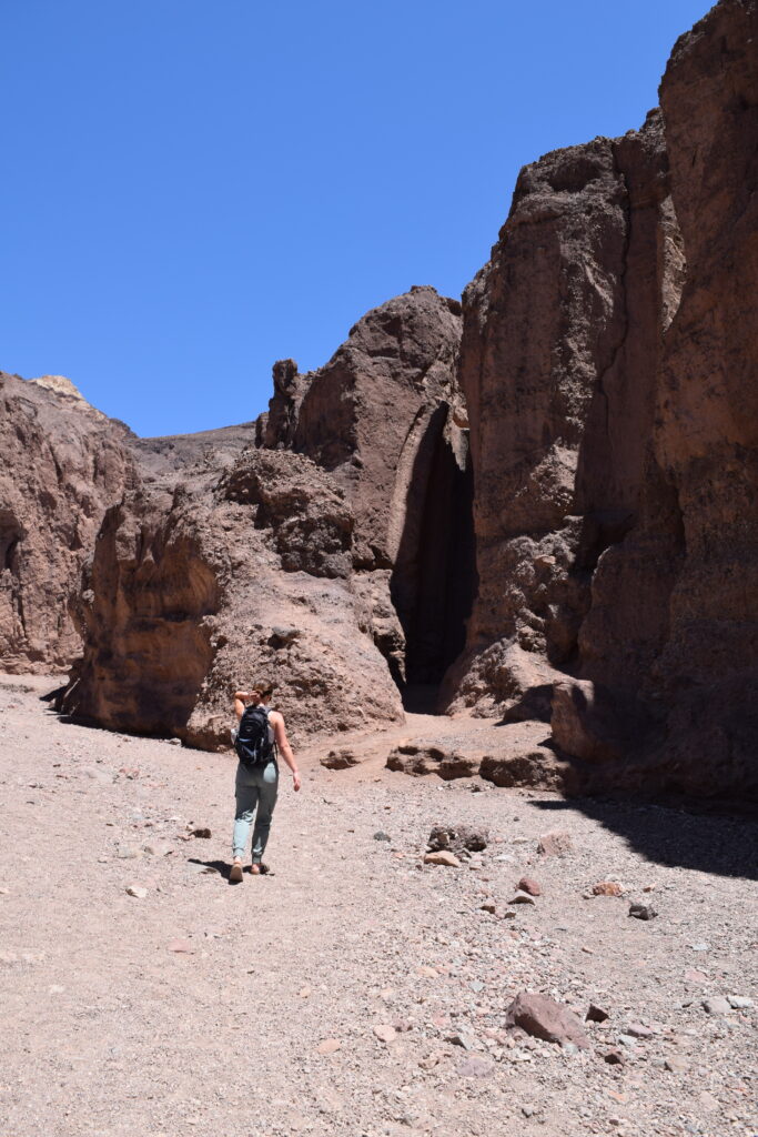
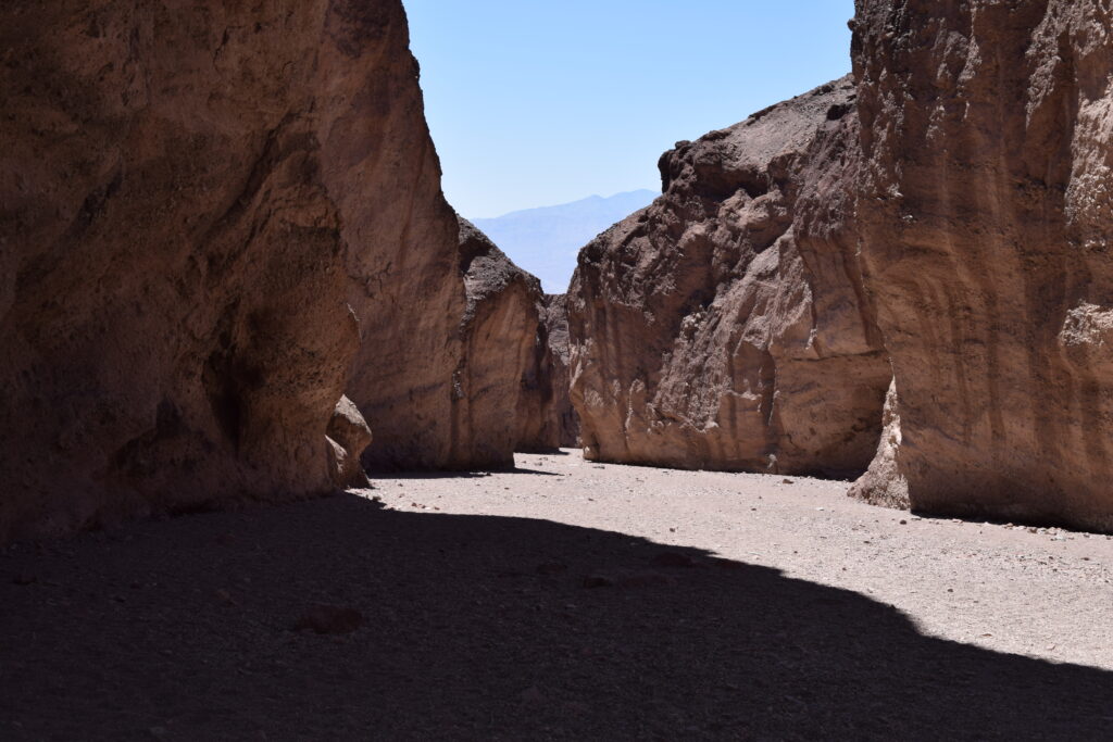
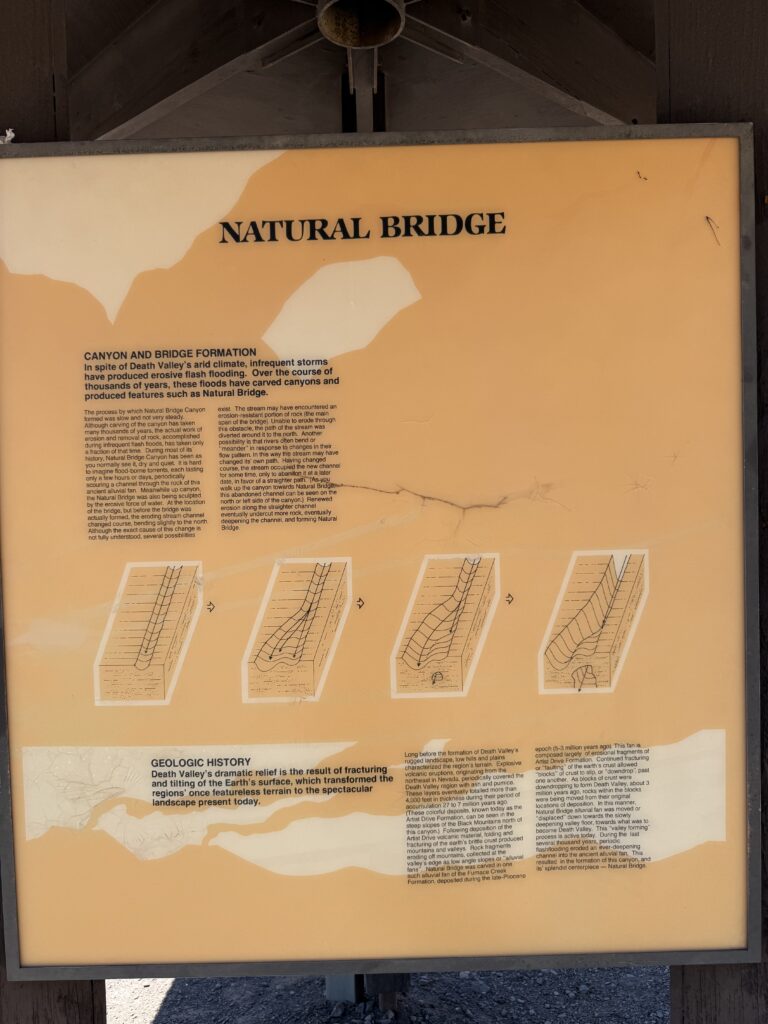
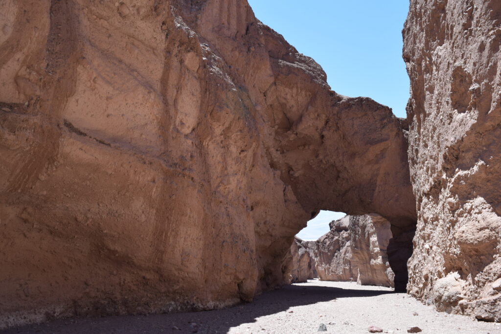
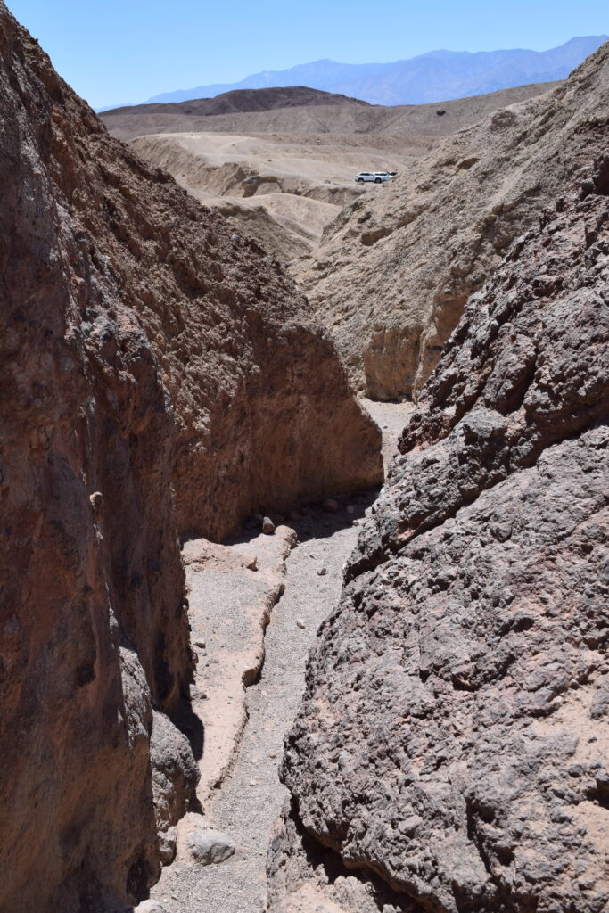
NATURAL BRIDGE
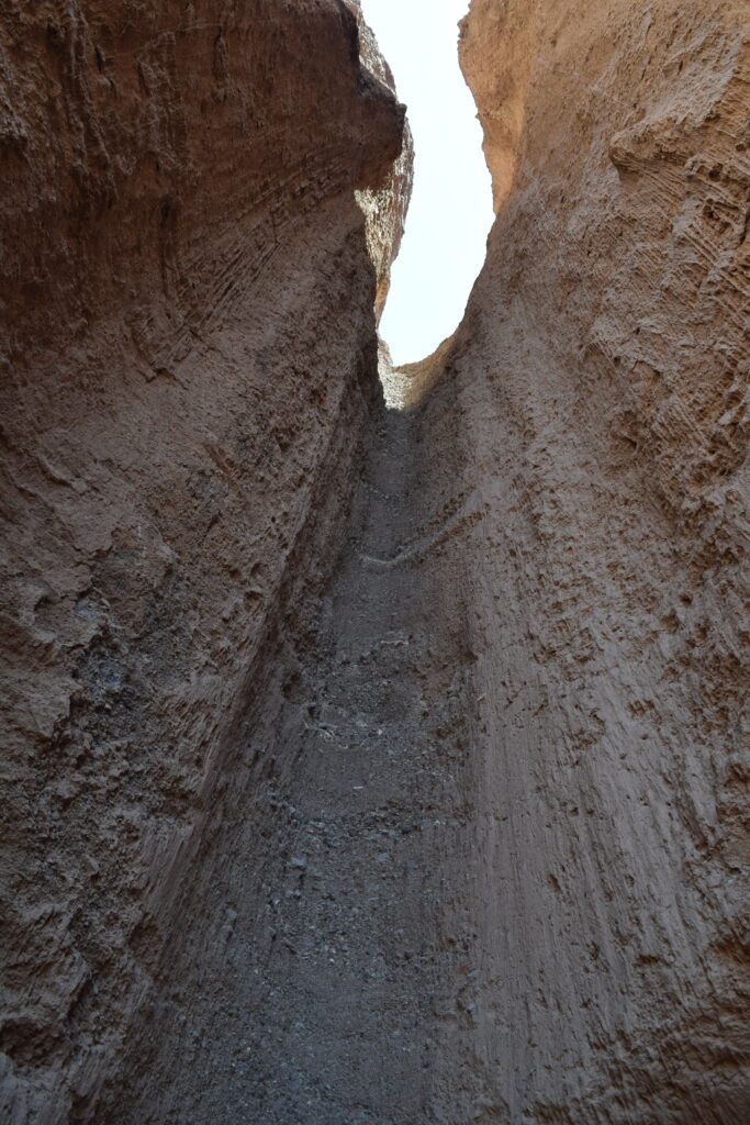
Just a short drive from Badwater Basin, Natural Bridge offers a quick and scenic hike that’s a bit off the main tourist radar. The road to get there is a gravel/dirt road — not too long, but definitely bumpy. We took it slow and had no trouble in a regular car, but it’s something to be aware of.
The trail is 0.75 miles one way and leads through a canyon to a stunning natural rock bridge that spans the path. The bridge itself is reached after just 0.3 miles, making it a great option if you’re short on time. After the bridge, the canyon continues and features dried waterfalls and a narrow, slot-like section — we hiked about halfway in before turning around and felt like we got a good taste of the trail without doing the full out-and-back.
This was one of the quieter spots we visited all day, and the peaceful desert silence made the scenery even more striking.
Pro Tip: This is a great stop to stretch your legs without committing to a long hike — and it adds a bit of variety to the day’s itinerary.
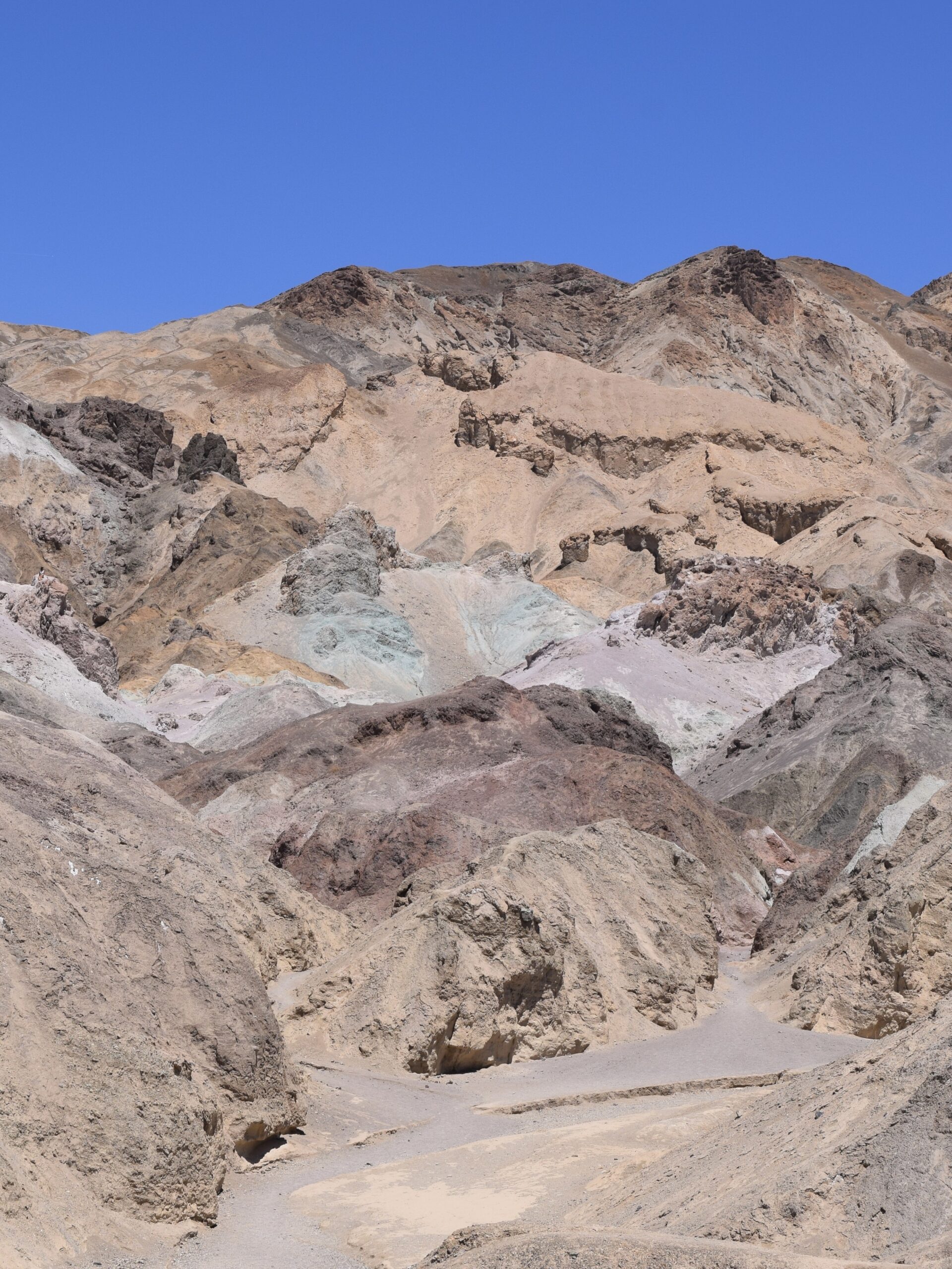
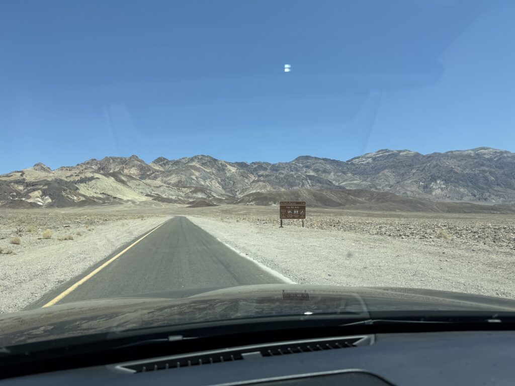
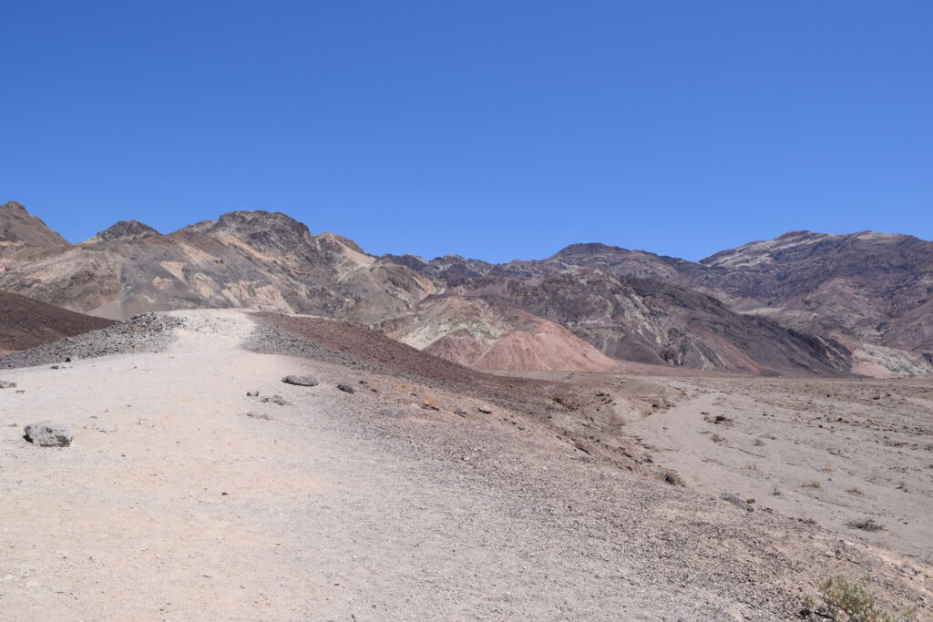
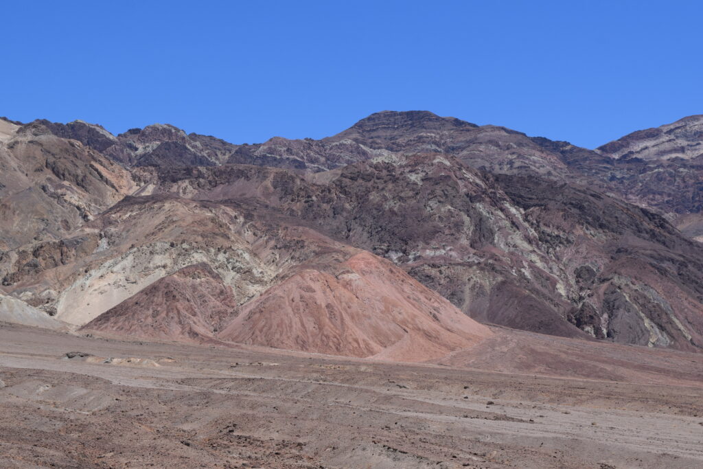
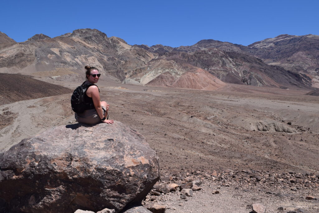
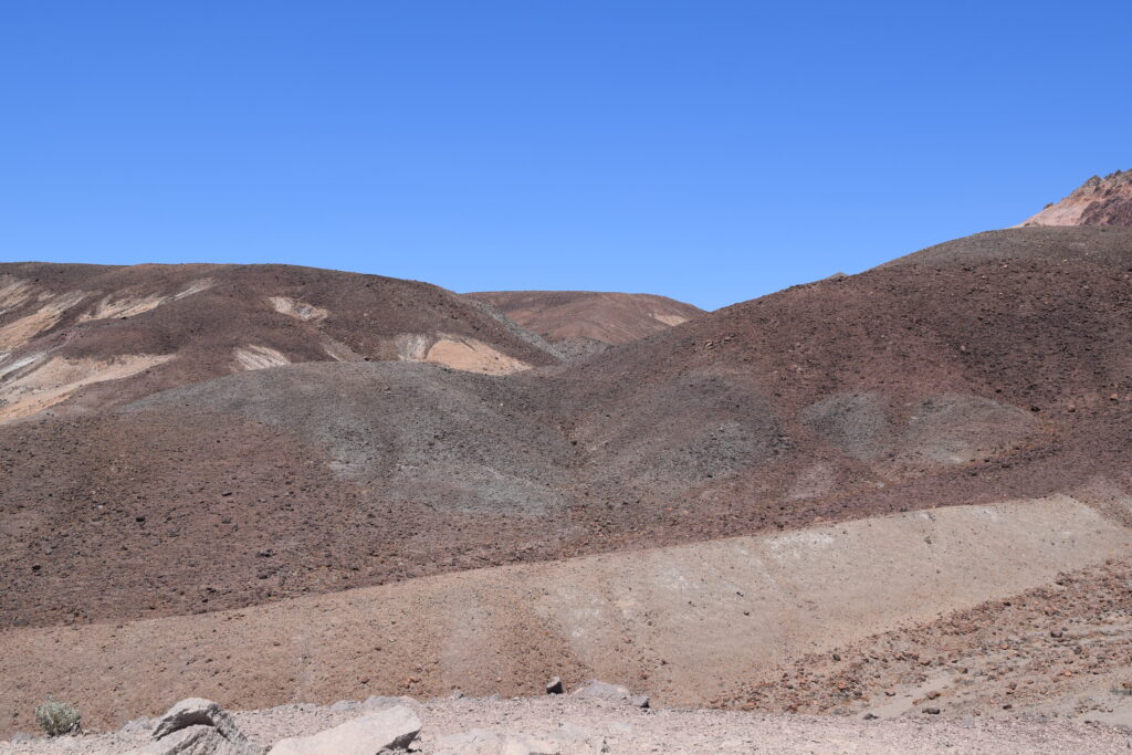
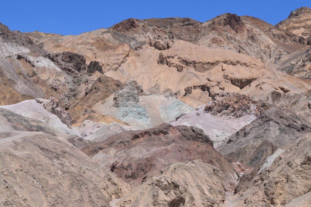
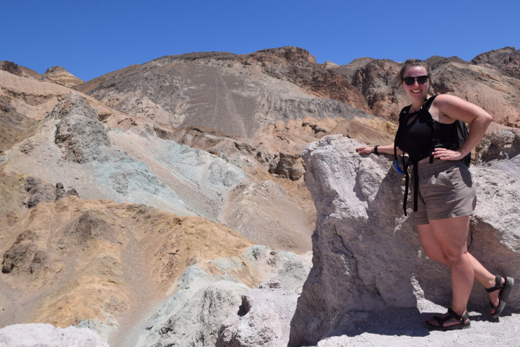
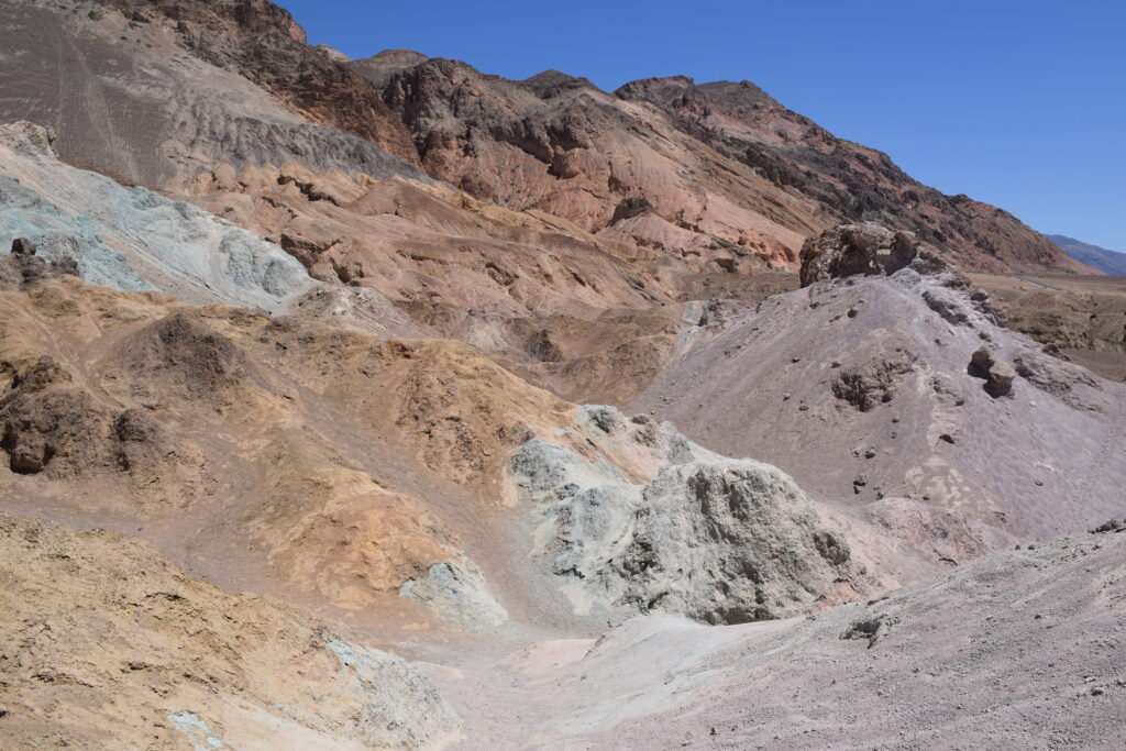
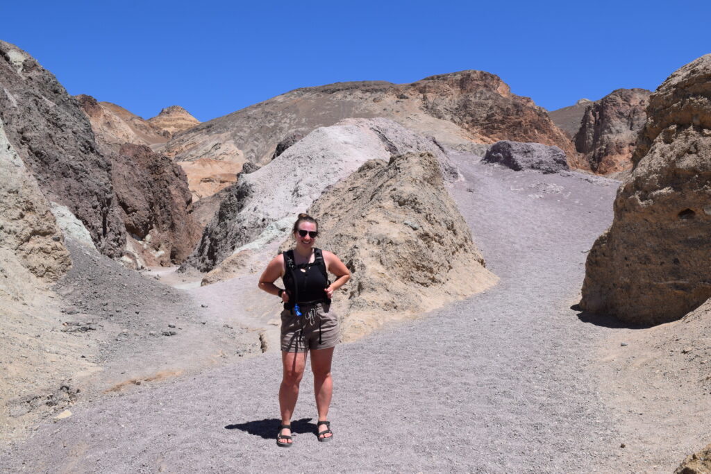
ARTISTS PALETTE
Next up is one of the most colorful — and unexpected — spots in the park: Artists Palette. To get there, you’ll take Artist’s Drive, an 8.5-mile one-way paved road that winds through the vibrant hills. It’s best to drive it from south to north, so it flows with your route if you’re heading north from Badwater Basin or Natural Bridge.
We made two stops along the way. The first was at Artist’s Drive Hill, where we just soaked in the layered pastel hills. Then we reached the main event — Artists Palette — a viewing area named for the incredible swirls of pinks, purples, greens, and blues in the rocks.
There’s a 0.3-mile loop trail here that takes you a little closer to the colors, and we absolutely recommend it. The hues are even more striking up close, and the formations are unlike anything else we saw in the park.
Pro Tip: The colors are most vibrant in the late afternoon when the sun is lower in the sky — but even midday, it’s still breathtaking.
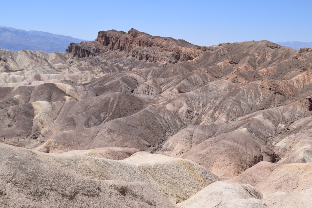
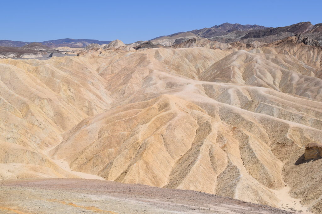
ZABRISKIE POINT
We wrapped up our one-day Death Valley adventure at Zabriskie Point, and it was the perfect finale. Located just off Highway 190, this overlook is easy to access and offers one of the most iconic views in the entire park. From Artists Palette, it’s about a 35-minute drive (22 miles) heading northeast.
From the parking lot, it’s a short paved path (less than 0.25 miles) to the viewpoint. What makes Zabriskie Point so special is the dramatic badlands landscape — wave-like ridges in shades of gold, brown, and cream, all shaped by ancient lake beds and erosion over millions of years. It feels like you’re staring into a prehistoric world.
We arrived in the early evening, and the lighting was beautiful, casting long shadows over the ridges and adding depth to the already surreal scene.
Pro Tip: This spot is especially popular at sunrise and sunset, when the colors come alive. But even outside golden hour, it’s still 100% worth the stop.


FINAL TIPS FOR VISITING DEATH VALLEY IN ONE DAY
DRIVING DISTANCES & TIMING
If you’re planning to follow this itinerary, here’s a quick breakdown of the key distances and drive times:
- Death Valley Entrance Sign to Stovepipe Wells: ~28 miles / 40–45 minutes
- Stovepipe Wells to Mesquite Flat Sand Dunes: ~2 miles / 5 minutes
- Sand Dunes to Furnace Creek Visitor Center: ~24 miles / 30 minutes
- Furnace Creek to Badwater Basin: ~17 miles / 30 minutes
- Badwater Basin to Natural Bridge: ~6 miles / 15 minutes (plus gravel road time)
- Natural Bridge to Artists Palette: ~10 miles / 20 minutes
- Artists Palette to Zabriskie Point: ~22 miles / 35 minutes
- Zabriskie Point back to Lone Pine (via Hwy 190 & 136): ~130 miles / 2.5 to 3 hours
WHAT TO PACK
- Water (lots of it — seriously)
- Snacks or a packed lunch
- Sunscreen, sunglasses, and a hat
- Comfortable walking shoes or hiking sandals
- Camera or phone with extra battery
- Offline map or downloaded Google Maps segment
OTHER TIPS
- Start early to beat the heat and the crowds.
- Fuel up in Stovepipe Wells or Furnace Creek — gas stations are limited.
- Expect winding mountain roads if you’re entering from the west (like we did) — it’s a scenic drive, just slower than expected.
- Check for road conditions and closures on the official Death Valley NPS website before you go.
Death Valley might be known for its extremes, but if you plan right, even a single day here can leave a lasting impression. From colorful hills to vast salt flats, this park surprised me in all the best ways — and I hope it does the same for you.
WHERE TO STAY NEAR DEATH VALLEY
Whether you’re looking for a cozy hotel, a rustic campground, or something in between, there are several great places to stay in and around Death Valley. Here’s a quick overview of the best lodging options based on location and experience:
FURNACE CREEK (INSIDE THE PARK)
Staying in Furnace Creek puts you right in the heart of Death Valley, close to top spots like Badwater Basin and Zabriskie Point.
- The Ranch at Death Valley – A more affordable and family-friendly option within the Furnace Creek area. It features a casual western vibe, an on-site restaurant, and access to a spring-fed pool — all while keeping you central to the park’s top sights.
👉 Check rates at The Ranch at Death Valley - Furnace Creek Campground – Operated by the NPS and a solid option if you’re tent camping or in an RV. Book early — this one fills up fast.
👉 Reserve a site at Furnace Creek Campground
STOVEPIPE WELLS VILLAGE (WESTERN SIDE)
Closer to Mesquite Flat Sand Dunes, this is a good choice if you’re entering from Lone Pine.
- Stovepipe Wells Village Hotel – A more budget-friendly option with an on-site restaurant, general store, and gas station.
👉 View availability at Stovepipe Wells Village Hotel - Stovepipe Wells Campground – Basic amenities and ideal for a simple, scenic camping experience.
👉 Book a site at Stovepipe Wells Campground
PANAMINT SPRINGS (WESTERN ENTRANCE)
A quieter spot with great views and fewer crowds.
- Panamint Springs Resort – Offers motel rooms, cabins, and tent camping. The on-site restaurant has great views of the desert landscape.
👉 Check rooms at Panamint Springs Resort
LONE PINE (90 MINUTES FROM THE PARK)
If you’re doing a day trip like we did, Lone Pine is a solid base — and the scenic drive into the park is part of the fun.
- Boulder Creek RV Resort – This is where we stayed, and we highly recommend it if you’re traveling with a camper or RV. They also have a few cabins available for rent, which is what we stayed in. The campground was well-maintained, and the amenities (like showers, laundry, and a small store) were super convenient. Plus, waking up to mountain views made the early drive into Death Valley a treat.
👉 Check rates at Boulder Creek RV Resort - Dow Villa Motel – Popular with travelers heading to Mount Whitney or Death Valley. Clean rooms and a pool.
👉 Check availability at Dow Villa Motel
PAHRUMP OR BEATTY (EASTERN ACCESS)
Ideal if you’re coming from Las Vegas or heading out that way.
- Saddle West Hotel & Casino (Pahrump) – A full-service hotel with a pool and restaurants.
👉 Check prices at Saddle West Hotel - Atomic Inn (Beatty) – Funky and fun — and just a 40-minute drive to the park entrance.
👉 See rates for Atomic Inn
Pro Tip: Lodging inside the park often books months in advance, especially during cooler months. If you’re visiting in spring or fall, reserve early!
READY TO PLAN YOUR OWN DEATH VALLEY ADVENTURE?
Death Valley might be known for its extremes, but as you’ve seen, it’s packed with beauty, variety, and adventure — even if you only have one day. From salt flats to painted hills, you can experience a surprising amount in just 24 hours with the right plan.
If you found this guide helpful, be sure to check out my other National Park itineraries and road trip tips. Or even better, join my email list to stay up to date on all my latest adventures and travel tips!
👉 Join the Travels with Kenzie email list here
👉 Explore more U.S. National Park guides
Have questions about visiting Death Valley? Drop them in the comments — I’m happy to help!
This blog post may contain affiliate links, which are at no cost to you. It just helps support me so I can continue to put out free content for you like this! Thank you for your support!